Soil samples drying for structural stability test
First, a quick warning. This is a fairly technical post, compared to previous posts, so if you're not so into soil science or water quality, skip this one and wait a few days. I'm working on another post with less data and more chat including photos of the amazing
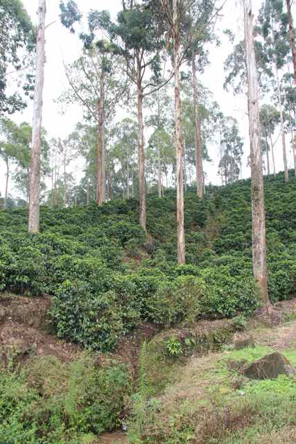
Punta Mona permaculture site in Costa Rica, which I visited in December, as well as landscaping developments on the Peninsula property and lots of spring and summer edibles propagating, planting and harvesting action.
In October and November, I was immersed in preparing a property plan for the Peninsula property as the major assignment in the postgrad subject,
Property and Catchment Planning. This involved a raft of monitoring, including physical and chemical properties of soil, and various water quality tests.
Soil testing
I began with some desktop research into soil mapping in the area. The most recent mapping of soils of the Mornington Peninsula was conducted in 2002-2003 for the Victorian Department of Primary Industry and the Mornington Peninsula Shire Council.
Soils occupying the slopes and lower parts of the south central portion of the Peninsula, where we are, are described as belonging to the Flinders Association mapping unit, while the plateau cappings and upper parts are the red volcanic soils of the Red Hill Association mapping unit. Flinders Association soils are classified (
Australian Soil Classification) as Brown
Dermosols with some Brown
Ferrosols; those of the Red Hill Association as Red Ferrosols with Red Dermosols.
Both the Flinders Association and the Red Hill Association mapping unit soils overly deeply weathered Tertiary basalt - basaltic rocks
extruded during the Tertiary period between 24 and 54 million years ago).
Physical and chemical properties typical of Dermosols, include:
- plant available water capacity greater than 100 mm (may exceed 200 mm in deeper soils)
- relatively good drainage due to well developed soil structure
- little restriction to aeration
- effective rooting depths are commonly 1.0 m
- susceptible to surface slaking upon rapid wetting, resulting in hardsetting if organic matter is low
- highly variable nutrient availability. Organic matter declines on cultivation
- aluminium toxicity may become a problem if pH levels decline to below 5.5
- good workability but a hardsetting surface will restrict workability in degraded soils. (From 2001 Australian federal government agricultural audit)
Onion grass (Romula rosea), a pasture weed, at site 4 in SE paddock, elevation 91m
I chose 6 sites for soil testing, representing different slope and drainage positions, and also different vegetation. For example, site 5 is in the woodlot, a block at the most elevated part of the property. Digging down to a depth of 25cm in that site revealed a soil profile much drier than anywhere else on the property, reflecting not only the increased water use by the trees in the woodlot but also the position of the site on the slope.
Site 6: soil profile to 25cm. Different horizons are represented (R to L): A 0-10, A2 10-15, B 15-20, B 20-25
I didn't find any evidence of Red Ferrosols. At each site I augured a hole to at least 30cm and inspected the soil profile to characterise the horizons. Other soil tests I did were: soil structural stability, field texture, salinity (Ecw and Ece) and drainage.
Soil profile
I found that soil profile characteristics were generally consistent with those given for Dermosols. The change of colour with depth (see how the colour lightens markedly at a depth of approximately 15cm at site 6 in the photo above) indicates the onset of a heavier clay profile, the B-horizon. The A-horizon will generally be the active root zone for most annual plants with maximum water availability and a soil structure that allows root penetration. The heavier clay of the B-horizon restricts root exploration and water availability.
The B-horizon began at approximately 20-30cm on most sites, but at site 2, at a low point on the property approximately 20m from the creekline, in tree belt of indigenous trees planted over 15 years ago by my parents, I couldn't find the B-horizon even digging down to 40cm. So in this area, there is over 40cm of topsoil - most likely a combination of the revegetation and the slope position. At this site, grass root density remained high until approximately 28cm depth. Drainage was also good with drainage of 20 ml occurring in under a minute. This contrasts to the wetter sites, such as site 3 where grass root density tapered off before 15 cm and drainage was 20 ml in 8 minutes.
Site 1: 2m above treeline, 85 m above sea level. Soil profile to 38cm: (L to R) B horizon (30-38cm), A2 (20-30cm), A1 (0-20cm). Note the difference in moisture between this site and site 6, above.
Structural stability
I conducted a rough structural stability test on soil from all 6 sites. Heavy soils are difficult to work (cloddy when dry, sticky when wet). Poorly structured soils are also often prone to erosion. These problem soils may need special management techniques for crop or pasture establishment.
The structural stability test involves taking a soil sample, air drying it then putting a pea-sized crumb from each horizon into a shallow dish with water (i.e. a jar lid). The dish is then left overnight. The next day cloudiness or milkiness around the base of the aggregate indicates a tendency to disperse. If particles are prone to
slaking, this will occur almost immediately. The degree of dispersion will determine the 'stability type' of the soil, from Type 1 where slaking is complete (i.e. reduced to a small heap of grains, losing shape completely) indicating a soil prone to crusting, erosion and poor drainage, to Type 4 where the aggregate is fully stable.
Site 6 soil showed more dispersion than soil at sites 1-5 and so I classified it as Type 3 ("moist aggregates, moderate dispersion") rather than Type 4 ("moist aggregates, slight dispersion")
Drainage
This is a simple crude test. Take a tin with both ends removed and firmly seat it on soil surface. Pour a given quantity of water into it (i.e. equivalent of 20mm depth) and measure that time it takes for this water to drain into the soil. The rate will vary with soil type and with the moisture status of the soil (i.e. drainage will be slower in soil that is already wet).
The drainage test indicated that drainage, and hence waterlogging, is not a problem. However, at site 3, the lowest point on the property, the B horizon was light grey with orange-yellow mottling. This colouring suggests a poorly drained soil in this area of the property. Planting trees that are sensitive to waterlogging in the root zone (i.e. avocadoes) would not be advisable in this area.
Field texture
This is my favourite test because it involves playing with soil. Basically you are exploring the plasticity or malleability of the soil, which involves assessing its cohesiveness, and are also feeling for texture (granularity).
Soil texture is the relative proportion of sand, silt and clay in soil. Moisten and knead a small bolus of soil in the palm of your hand to form a ball and assess what grade you think it is according to the
standard chart, based on how the ball holds together, whether it can be rolled into a ribbon as well as the feel of the soil particles.
I assessed soil at all sites to be clay loam (ball holds together, ribbon length 3.8-5 cm, feel is plastic and smooth to manipulate).
Site 4: field texture assessment. Ribbon of 6 cm.
pH (acidity)
I used a good old Barium sulphate colourmetric kit, developed by CSIRO and sold at Diggers. Not surprisingly on this property, which has history of grazing on 'improved pastures', all sites had low pH (5). I did an additional pH test on soil taken from directly underneath one of the nut trees on the swale. The soil immediately around these trees has received regular applications of compost, seasol and compost tea, as well as mulching. The pH on this soil was between 7-8, which is not surprising given the soil amendments applied.
Should grazing or horticulture be conducted in future on this property, acidification is likely to continue unless measures are taken arrest the decline in pH. Soil acidification can lower the agricultural productivity of soil in many ways, including reducing the availability of nutrients such as phosphate, or increasing the solubility of elements, such as aluminium, to toxic levels.
Contrast between pH of soil under the trees on the swale (dark sample at left) versus site 3 (two green samples at right).
Salinity
Salinity, a term used to describe salt content in soil and water, is a natural product of geological weathering: some rocks gradually release salts as they weather. While most of this released salt remains at low concentrations, some is stored in the soil profile and can be dissolved and relocated by precipitation or groundwater. It is left behind and accumulates as the water is drawn off: for example through evaporation. Primary salinity is the term given to this salinity that occurs from naturally occurring processes. It encompasses not only salinity from geological weathering but also cyclic salting (seawater droplets carried by wind over the landscape, then evaporate, depositing tiny salt particles onto the ground; or salt is deposited with rainfall).
Prior to European settlement, the hydrological system can be said to have been in balance: the rate at which water entered the groundwater system was balanced by the rate of water uptake by native vegetation and by slow percolation into the ground, terrestrial water bodies, and eventually the ocean. Groundwater discharge, as freshwater, mineral springs and occasionally highly saline springs, varied naturally as a part of that equilibrium, responding to seasonal and long-term changes in rainfall.
However, farming practices since European settlement have altered the hydrological balance, interfering with groundwater flow systems, mobilising stored salt and causing secondary salinity. Practices that contribute to secondary salinity include the clearing of deep-rooted perennial native vegetation and its replacement with shallow-rooted annual crops and pastures, and certain irrigation practices. Salinity reduces soil fertility and impacts negatively on soil structure and water relations, leading to increased erosion.
Although salinity mapping has been conducted by local authorities on the Peninsula, very little shallow watertable and discharge mapping has actually been completed on private non-urban land. So even though there are no salinity areas on the public record on the in my area, this doesn't mean that salinity is not a risk or that land management decisions in the area won't affect salinity in adjacent areas, at the catchment or sub-catchment level. on the Peninsula. Land uses and management practices in our area may well contribute to salinity elsewhere in the region, due to the interconnectivity of groundflow systems. Also, it should be remembered that the timescale on which salinity is affected by land use changes is in the order of decades.
Laboratory soil testing
In 2008, soil at 5 different sites on the property was tested for a range of chemical properties, listed below, by APAL laboratories. Back then, I asked the lab to provide a report tailored to growing of fruit and nut trees.
Properties tested:
• Total exchange capacity (TEC)
• Colloidal organic matter %
• pH (water)
• Anions: nitrogen, sulphate, phosphate (Olsen), phosphate recovery %
• Cations: calcium, magnesium, potassium, sodium (Na)
• Chlorides
• Salinity (EC 1:5) (dS/m)
• Trace elements: cobalt, boron, iron, manganese, copper, zinc, molybdenum, aluminium
• Base saturation % Ca:Mg ratio, calcium, magnesium, potassium, sodium, other bases, exchangeable hydrogen
The report concluded that the fertility was generally low for the purposes of fruit and nut tree growing. The main issues found were low calcium and high magnesium, which, the report concluded “will be making the soil tight, sticky and difficult to work with.”
Phosphorous and potassium were found to be significantly deficient. In the trace elements, boron, manganese and zinc were found to be deficient. Organic matter levels were found to be sufficient but it was thought that low calcium levels would “limit soil microbial activity”. The pH of soil sample 0-10cm was 5.4 (water); that of the 10-15cm depth was 5.
Recommendations for soil amendments included lime, rock phosphate, borax, zinc sulphate, manganese sulphate and sulphate of potash, and boron (foliar). Deep ripping in prospective tree lines was also recommended. Applications of manure were recommended to maintain organic matter levels.
Phosphate losses from this soil are likely to have occurred due to:
• Removal of phosphate in pasture by grazing and cutting for hay.
• Leaching losses. Plant-available phosphorous exists in soil in the form of phosphate anions, which as they are negatively charged are not retained on negatively charged clays
• The low pH is a factor likely to have contributed to relatively high rates of loss by leaching in this soil. Phosphate anions in acid soils precipitate as insoluble compounds of iron and aluminium.
Aquatic environments and water resources
The new dam (there are 2 dams on the property) seen from the kitchen window of the new house. Pablo and Luna do not seem to be as interested in water quality as I am. The wild ducks that have taken up residence on the dam are, however, a constant source of fascination, and anxiety, for these two.
The western border of the property follows a tributary a local creek which flows to the south and towards Westernport bay. Over the past 20 years the tributary has either stopped flowing in the height of summer or flowed at a much reduced rate. Flow may also be affected by our upstream neighbour's practice of temporarily damming the tributary in dry times in order to irrigate his pastures (hmmmm).
From conversations with neighbours, I'm reasonably confident that this streamline is spring fed by at least two known springs: one approximately 2 km to the North West; another approximately 100 m to the NE. Both springs are reported to be ephemeral. In the past 6 months, with good rains, the owner of the property on which the second spring is located has advised that it has started running again after being dry for over 7 years. A drainage line on this neighbouring property is the conduit for water from this spring to enter the tributary on our property.
There are two small dams. The first with an approximate capacity of 1-1.5ML. Water is pumped upslope from this dam to:
• irrigate the small domestic orchard to the east of the original house, the two vegetable patches and the landscaping plantings around the new house
• irrigate the nut and avocado trees on the swale mound in the southern paddocks
The second dam, built in 2009, has a capacity of 0.7-1 ML. It is connected to two flanking swales on contour. The swales don't connect with the creek. Water from this dam is not yet used for irrigation. The grey water system for the new house has been constructed so that it can be diverted to the swales but at present goes through the blackwater septic system. Tank overflow from the new house goes directly into the dam.
I did a day's
training with Melbourne Water's Waterwatch Program. Karri, a local who has been water testing the Creek under the Waterwatch program with Landcare for years, also helped me with equipment and technique (thanks Karri!). We tested the creek and dam water for:
- temperature
- pH
- electrical conductivity (a measure of salinity) (using a meter)
- dissolved oxygen (colour-metric kit in combination with a Melbourne Water Waterwatch Program Dissolved Oxygen Monogram that
calculates saturation as a function of water temperature and dissolved
oxygen in mg/L)
- phosphate (colour-metric kit)
- turbidity (turbidity tube in NTU units).
I also took some water samples and did some macroinvertebrate identification, using a Waterwatch Guide and
some other internet resources. Each type of macroinvertebrate group has a grade from 1-10 based on its sensitivity to pollution. The higher the number, the more sensitive the animal is. The assessment technique provides an overall score by taking into consideration the sensitivity of the macroinvertebrates present and their abundance.
"Macroinvertebrates respond to the presence of longer term pollution or changes in water quality as compared to water quality testing which only assesses health, or presence of pollution for that point in time and is highly specific (test for pH, phosphorus etc). For instance, stonefly nymphs are very sensitive to organic pollution such as turbidity, if you have had reoccurring events that cause turbidity, but only sample turbidity once and an event hasn’t occurred that day, you may not know about the usually high turbidity. The absence of stoneflies in a waterway where they usually occur may help you determine that something more long term has been going on. For another example, a higher than normal presence of bloodworms and a drop in other species occurrence could indicate low dissolved oxygen levels as blood worms are very tolerant to low oxygen conditions." (From Victorian WaterWatch manual, biological parameters)
Basically, the type and numbers of different aquatic insects are an indication of water quality - you use a standard correlation chart that correlates types and numbers of particular insects with water quality.
Caddisfly in water sample from creek tributary. Caddisflies disguise themselves by living within claddings of reeds or other organic material like sticks. Caddisflies are very sensitive to pollution so good numbers indicate that water quality is good.
According to the macroinvertebrate survey, the water quality index of the creek and dam no. 1 is 'fair'. I assessed the water quality of dam no. 2 as 'poor'. This may be because the dam received water pumped out of the tank at the new house during the build. It may also be that this dam has relatively poor bank vegetation compared to dam no. 1, and hence little shade to protect shallow-water organisms from the effects of high temperatures.
Biodiversity monitoring
I also did a survey of existing native and introduced plant species, a big task but helped by pasture and weed identification studies that I've already done as part of my degree. In addition to introduced pasture grasses such as Cocksfoot (Dactylis glomerata), Yorkshire fog (Holcus lantana), we also have some more insidious weeds such as Curly dock (Rumex crispus), and of course Blackberry (Rubus fruticosis).
Curled Dock (Rumex crispus) on the property. Curled Dock is a tap rooted perennial, 50-150 cm high, commonly found in seasonally to semi-permanently wet areas
So what's this all for?
Well, it informs the development of a property plan. Some info about the first cab off the rank - native sandalwood agroforestry - is coming up in the next post. Stay tuned.
Marie Antoinette


